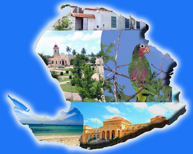
Isla de la juventud. The second largest island in the Cuban archipelago is part of Canarreos Archipelago, with over 600 keys and islets, in the southwestern part of Cuba, on the Gulf of Batabano. It is a special municipality and its capital city is Nueva Gerona

Geographical map of la Isla de la Juventud
Physical geography
Relief | Weather | Hydrography | Soils
RELIEF
The Isla de la juventud, by its physical-geographical characteristics, is divided in two areas.
The northern area (1312 km2) with a relief of rolling plains, savannas and valleys; standing out , La Cañada, with 303 meters, overlooking the whole island, the surrounding sea and the heights of the other marble elevations; Sierra Caballo 298 meters, 270 meters Sierra Las Casas, formed by two mountain chains stretching from north to south for a distance of four kilometers, both divided by an open and several creeks; Cerro de Colombo and La daguilla , among others.
The southern zone (850 km2) in the Lanier Swamp of 38 km2 , being the natural boundary between the north and south of the island. Dividing this area in the East Marsh and West Marsh, is a plain totally covered with vegetation. Cerro Caudal stands out with a height of 30 m. entirely of marble.
It has more than 30 km. of sandy beaches alternating with cliffs and mangroves.
The cays extend in the east. It is an area of great ecological interest as they provide valuable refuges for flora and fauna. The fine, white sand beaches are of great value for tourism.
Up
WEATHER
The climate of the island is that of plains and heights with relatively stable seasonal wetting, high evaporation and high temperatures. There are two distinct seasons: a rainy season (May to October) and a less rainy (November to April).
The climate is warm with temperatures fairly stable, with an annual average of 24.8 ° C, July is the warmest month with an average temperature of 27.9 ° C. The coldest month is February with an average of 17.3 º C. The lowest temperature recorded was 6.1 ° C and the highest recorded is 35.1 ° C.
The rainfall pattern is affected by local conditions: showers and squalls. The maximum corresponds to the months of June and September with averages of 319 and 240 mm respectively. The minimum was recorded in March and December with averages of 34.8 and 42.3 mm respectively. In the dry season rainfall is contributed by frontal systems (cold fronts) that have the highest influence in the months of January and February. In the rainy season tropical organisms such as depressions, cyclones and hurricanes have a great influence.
The easterly winds and EN are predominant during the rainy season. Between November and April winds from the north and south alternate.
The annual relative humidity is 80%, being higher in the months of July to November.
Several hurricanes such as "Gustav" and "Ike" have stricken the island leaving their marks behind....
| HURRICANE GUSTAV |

Hurricane Gustav - Isla de la Juventud

Hurricane Gustav - Isla de la Juventud

Hurricane Gustav - Isla de la Juventud

Hurricane Gustav - Isla de la Juventud

Hurricane Gustav - Isla de la Juventud

Hurricane Gustav - Isla de la Juventud

Hurricane Gustav - Isla de la Juventud

Hurricane Gustav - Isla de la Juventud

Hurricane Gustav - Isla de la Juventud

Hurricane Gustav - Isla de la Juventud

Hurricane Gustav - Isla de la Juventud

Hurricane Gustav - Isla de la Juventud
|
| |
| HURRICANE IKE |

Hurricane Ike - Isla de la Juventud

Hurricane Ike - Isla de la Juventud

Hurricane Ike - Isla de la Juventud

Hurricane Ike - Isla de la Juventud

Hurricane Ike - Isla de la Juventud

Hurricane Ike - Isla de la Juventud

Hurricane Ike - Isla de la Juventud

Hurricane Ike - Isla de la Juventud
|
Up
HYDROGRAPHY
Rivers
Its hydrography is made by the rivers: Las Nuevas Casas, Santa Fe, San Pedro, Júcaro, La Jagua, Middle, Los Indios. The longest one with 28 km. is Las Nuevas. Born at an altitude of 30 meters flows into Punta de Tirri. It has six tributaries.
Las Casas with 17 km. extension with 14 small tributaries flows through the city of Nueva Gerona from south to north. Used for maritime-port transportation, sports, tourism and industrial activities.
San Pedro, and La Jagua flow into the Lanier Swamp, and others are dammed.
Reservoirs and dams
Up to 170 million m3 of water are dammed. The main dams are: Viet Nam, Del medio, Las Nuevas, Cristal, El Abra, Los Indios, La Fe, El Enlace, Casa Dos, La Guanábana, Mal País Uno y Mal País Dos and Sierra Maestra.
Sea, coasts and beaches
The sea around the island on the west, north and east, is not deeper than ten meters, its average depth is seven meters. These include shallow seas 34,145 km2, which contributes greatly to the water evaporation and increase of the average temperature, precipitation, and humidity.
The rugged coastline is the least prevalent. On the north coast the hills of Colombo and Punta Bibijagua can be found. In the south coast are in Punta del Este and Punta Frances
The northern beaches are small with black and gray sand, contrasting with the long beaches of fine white sands of the south, and a diverse range of seabed landscapes and a variety of corals, gorgonians , sponges and a huge variety of fish species.
Springs
Medicinal mineral springs are an important resource. The main ones are those located in Santa Fe for drinking and medical use. And the Rosario in the Demajagua for therapeutic purposes.
Up
SOIL
Hydromorphic soils predominate in the coast, ferric in the north and center, are humic calcimorphous south.
The north, is rich in minerals such as rock crystal, iron, marble, kaolin, gold, silica sand and others. It can produce a variety of agricultural products such as grapefruit, orange, lemon, melon, watermelon, mango, guava, papaya, guava, star apple, custard apple, cashew, pineapple, mamey, avocado, breadfruit, tamarind, sweet potato, potatoes, yams, taro, cassava, sugar cane, beans, corn, snuff, onion, garlic, tomato, pepper, chili, lettuce, cabbage, rice and more.
The south is a rocky plain with the swamp forests of Galerias and El manglar.
Up |


